GPS Map Camera & GeoTag: Geotag Photos & Add GPS Location
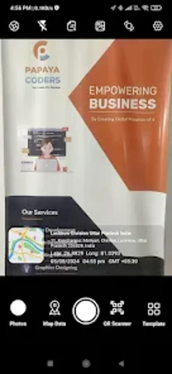
GPS Map Camera & GeoTag is a versatile app that enables users to enhance their travel memories or work-related tasks by embedding precise details like date, time, live map, latitude, and longitude onto their photos. Users can also easily share geotagged images with friends and family, allowing them to immerse themselves in the captured moments.
With GPS Map Camera & GeoTag, users can customize their camera settings with various features like Grid, Ratio, Flash, Timer, and more. The app offers two templates - Classic and Advanced, each providing different options for adding GPS location stamps to images. It also includes a QR code scanner for quick scanning and integration of location data.
Ideal for government employees, travelers, professionals in various industries, bloggers, and event attendees, GPS Map Camera & GeoTag is a valuable tool for anyone looking to enrich their photos with GPS data. Download the app today to explore its unique features and enhance your visual storytelling.